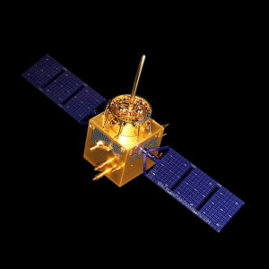
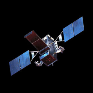
The Yaogan satellite series is a constellation of Chinese reconnaissance satellites designed for remote sensing purposes. Launched by China, these satellites serve various national security and defense needs. Notable achievements include their role in providing high-resolution imagery for military reconnaissance and surveillance missions.
Design and Construction
The Yaogan satellites feature advanced imaging systems capable of capturing high-resolution images of Earth’s surface. Constructed using lightweight yet durable materials, these satellites are equipped with solar panels to power their onboard systems. Unique engineering challenges during development included optimizing the satellite’s design for long-duration missions and ensuring reliable data transmission back to Earth.
Mission Objectives
The primary mission objective of the Yaogan satellite series is to enhance China’s reconnaissance capabilities by providing real-time imaging and surveillance data. Secondary objectives include supporting disaster monitoring, agricultural planning, and environmental protection efforts.
Launch and Deployment
Yaogan satellites are typically launched atop Long March rockets from various space centers in China. Each launch is meticulously planned to ensure precise orbital deployment, allowing the satellites to achieve optimal coverage and revisit rates. Key milestones include successful launches and achieving operational orbit configurations.
Technical Specifications
- Dimensions: Varies depending on specific satellite model.
- Weight: Typically several hundred kilograms.
- Payload Capacity: Equipped with optical or synthetic aperture radar (SAR) imaging systems.
- Propulsion System: Utilizes onboard thrusters for orbit adjustments.
- Power Source: Solar panels provide electrical power during orbit.
- Instruments and Equipment: Optical or SAR imaging systems for Earth observation.
Current Status
The Yaogan satellite series remains active, contributing valuable data to China’s national security and defense efforts. Ongoing missions involve continuous monitoring of strategic regions and activities of interest. Future plans may include the development of next-generation satellites with enhanced capabilities and improved performance.