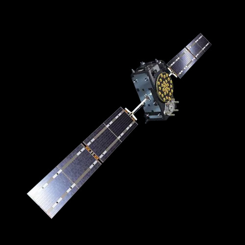
Earth orbits are primarily classified based on their altitude, inclination, and orbital shape, which determine their behavior, uses, and interactions with Earth’s environment. The most common types are Low Earth Orbit (LEO), Medium Earth Orbit (MEO), Geostationary or Geosynchronous Orbit (GEO/GSO), and Sun-Synchronous Orbit (SSO), though there are also specialized orbits like Very Low Earth Orbit (VLEO) and Highly Elliptical Orbits (HEO).
Main Types of Earth Orbits and their classification
Here’s an overview of key Earth orbits. This classification guides satellite design, mission planning, and operational strategy, from rapidly orbiting LEO satellites for imaging to geostationary satellites providing constant global communications coverage.
Low Earth Orbit (LEO)
Summary: A fast orbit (~90 minutes per revolution), commonly used for Earth observation and crewed missions. It offers low latency and high-resolution imaging due to proximity to Earth. But satellites in LEO experience atmospheric drag, leading to orbital decay over time!
Low Earth Orbit, typically ranging from about 160 to 2,000 kilometers above Earth, is the closest orbital region. Satellites here orbit the planet very quickly, completing a revolution roughly every 90 to 120 minutes. The proximity to Earth makes LEO ideal for high-resolution Earth observation, scientific missions, and communication constellations, but the thin atmosphere still present causes drag, gradually slowing satellites and requiring orbital corrections over time.
Altitude: ~160–2,000 km
Examples: The International Space Station, Earth observation satellites, the Hubble Space Telescope, and satellite internet constellations like Starlink.

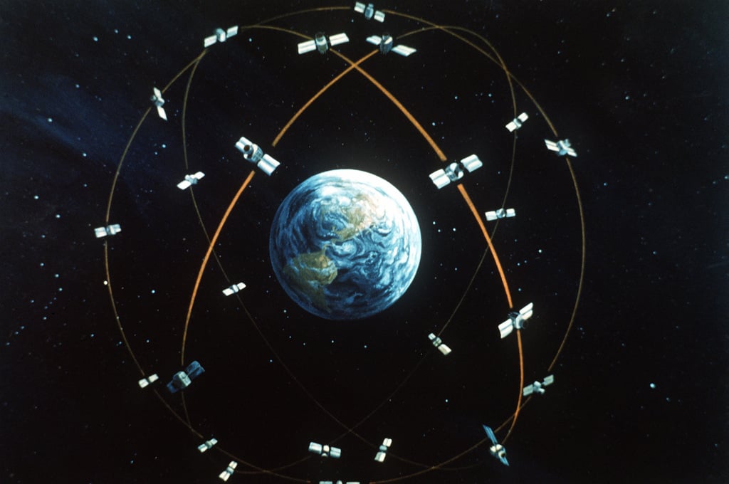
Medium Earth Orbit (MEO)
Summary: Satellites in MEO have orbital periods ranging from about 2 hours to just under 24 hours. MEO satellites experience perturbations from solar radiation pressure and other forces.
Medium Earth Orbit extends from roughly 2,000 kilometers up to the geostationary altitude of about 35,786 kilometers. MEO satellites have longer orbital periods, ranging from a few hours to nearly 24 hours, and are commonly used for navigation systems. These orbits strike a balance between coverage area and signal delay, making them ideal for global positioning and timing services.
- Altitude: ~2,000–35,786 km
- Examples: Primarily used for navigation satellites like GPS, GLONASS, and Galileo.
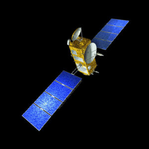
Geostationary Orbit (GEO)
Summary: Satellites in this orbit match Earth’s rotational period, appearing stationary relative to a fixed point on Earth’s surface. It requires precise positioning and station-keeping maneuvers to maintain orbit.
Geostationary and geosynchronous orbits occupy a special altitude at approximately 35,786 kilometers above the equator. Satellites in a geostationary orbit revolve at the same rate as Earth’s rotation, appearing stationary relative to a fixed point on the surface. This makes them perfect for communications, broadcasting, and meteorology, although precise station-keeping maneuvers are necessary to maintain their position. Geosynchronous orbits, while sharing the 24-hour period, may have inclined or slightly elliptical paths, causing a figure-eight motion relative to Earth.
- Altitude: ~35,786 km
- Examples: Ideal for communication, weather monitoring, and broadcasting satellites.
Sun-Synchronous Orbit (SSO)
Summary: A near-polar orbit where the satellite passes over the same point on Earth’s surface at the same local solar time, maintaining consistent lighting conditions. Achieved through orbital precession, this orbit aligns the satellite’s orbit with Earth’s position relative to the Sun.
Sun-synchronous orbits are a subset of near-polar LEOs designed so that a satellite passes over the same point on Earth at the same local solar time. This consistent lighting is particularly advantageous for Earth observation and environmental monitoring. It is achieved through careful inclination and orbital precession that align the satellite’s orbit with the Sun.
Examples:
- Landsat series – A long-running Earth observation program by NASA/USGS. Landsat satellites use SSO to capture consistent, high-resolution images for environmental monitoring, agriculture, and urban planning.
- Terra and Aqua – NASA’s Earth-observing satellites part of the Earth Observing System (EOS). Terra monitors land and atmosphere, while Aqua focuses on water cycles, both relying on SSO for consistent solar illumination.
- Sentinel satellites (Sentinel-1, Sentinel-2, etc.) – Part of the European Space Agency’s Copernicus program. These satellites use SSO for radar imaging and optical Earth observation, aiding in disaster monitoring, climate studies, and land-use mapping.

Other Orbit classifications
Other orbital classifications depend on orbital shape and eccentricity. Highly elliptical orbits have pronounced eccentricity, allowing satellites to spend extended periods over high-latitude regions, which is useful for communications in polar areas.
Geosynchronous Orbit (GSO) and Geostationary Transfer Orbit (GTO)
GSO: An orbit with a period equal to Earth’s rotation (24 hours). Satellites may appear to move in a figure-eight pattern relative to the surface.
GTO: Alliptical orbit used to transfer satellites from LEO to GEO. It has a low perigee near Earth, apogee at geostationary altitude. You can learn more about this orbits in this article: Geostationary Transfer Orbit (GTO) vs Geostationary Orbit (GEO).
Heliocentric Orbit (HCO)
An orbit around the Sun instead of Earth, it is used for interplanetary missions and solar observation.
Highly Elliptical Orbit (HEO)
An orbit with an elliptical shape with one high and one low point, it provides extended coverage over specific regions
- Examples: Molniya orbits for Russian communications.
Near-Rectilinear Halo Orbit (NRHO)
A highly stable elongated lunar orbit. It is used for lunar gateway stations with constant line-of-sight to Earth and Moon.
Polar Orbit
Inclination: ~90°
Passes over Earth’s poles; allows coverage of the entire surface over multiple passes.
Common for Earth observation satellites.
Suborbital orbits / other specialized orbits
Some missions use temporary or highly customized trajectories for testing or interplanetary transfers.